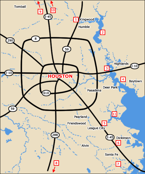
1. Upper San Jacinto River
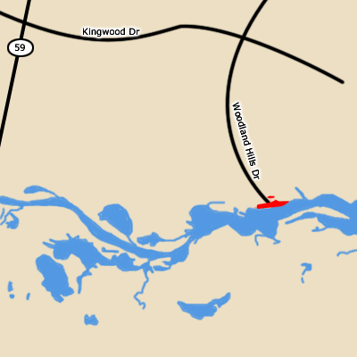
From Houston:
Take 59 N EXIT Kingwood Dr. Turn RIGHT
Take Kingwood to Woodland Hills Dr Turn RIGHT
Follow Woodland Hills Dr until you reach the ramp
2. Lake Houston
3. Lower San Jacinto River
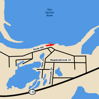
From Houston:
Take I-10 E
Take the MONMOUTH DR exit- exit number 786. 0.1 miles
Turn LEFT onto MONMOUTH DR. 0.2 miles
Turn LEFT onto MEADOWBROOK DR. 0.1 miles
Turn RIGHT onto PARK DR. 0.1 miles
Go STRAIGHT. 0.1 miles
Turn SHARP RIGHT onto RIVER RD. 0.1
4. Cedar Bayou
5. Clear Creek
6. Dickinson Bayou
7. Diversionary Canal
8. San Bernard River
9. Lake Conroe
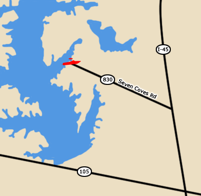
From Houston:
Take I-45 N
EXIT FM 830 (Seven Coves Rd) turn LEFT
Follow Seven Coves Rd until you reach the ramp
10. Trinity River
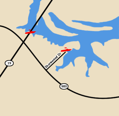
From Houston:
Take I-45 N towards Huntsville.
Take exit 113 to HW19 N towards Trinity.
There is a public boat ramp on 19 just past the Town of Riverside.
Bethy Creek boat launch is located off of FM980.
11. Clear Lake
|